Below is a selection of the projects that I have worked on this year at Selkirk College as part of my Advanced Diploma in GIS:
Please click on the link below to access my Story Map that was created for Internet Mapping (GIS325): http://selkirk.maps.arcgis.com/apps/MapSeries/index.html?appid=7e3f1634168c4223b95e9376ea7e0452; Below is a screen shot of one of the pages included, that incorporates data from my Remote Sensing final project (GIS307): 
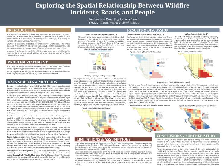
The poster style ‘map’ below was created for GIS331 – Advanced Topics in GIS:
The poster below was created for GIS318 – Cartography and was presented during GIS Day in November 2017 at Selkirk College, Castlegar Campus.

This map below was created for GIS321 – New Media in GIS where we explored the use of an Air Mile Index to show different ways to symbolize and convey data.

Below is a selection of minor assignments from GIS321 – New Media:


For GIS325 – Internet Mapping we created Google Maps that we can embed using HTML code; below is the map that I created – try zooming around and clicking on the points!
